Nearby stations. Next trains.
Open.
Look.
Go.
Open FastStation and see your nearest stations and upcoming trains right away. No station search. No digging through menus. Just what’s coming.
Free on the App Store · iPhone & iPad · iOS 26.0+
Find your citySubway 4 · 5 · 6 · 7 · Shuttle / All directions
Simulated times, not live travel information.
See what’s available in New YorkYour nearest stations are the first thing you see in the app.
01 / Nearby, right away
A quick glance.
And you’re off.
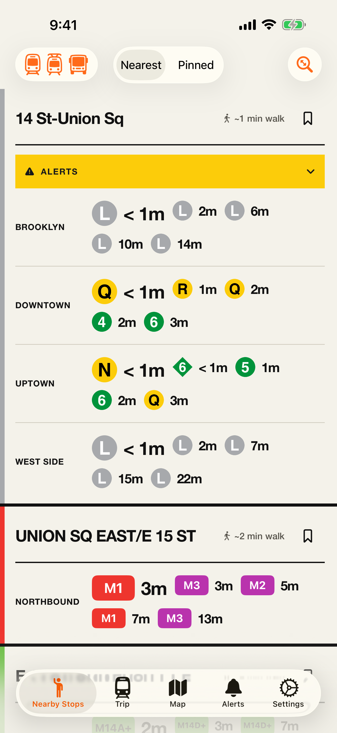
You’re on the sidewalk. The train is on its way. Open FastStation and the nearest stops are already waiting for you.
Every direction. At a glance.
See what’s coming uptown, downtown, or across town. Big route markers. Clear arrival times.
Make your regulars a tap away.
Pin your daily stops so home, work, and the way between feel a little more familiar.
02 The whole trip
Across town.
All figured
out.
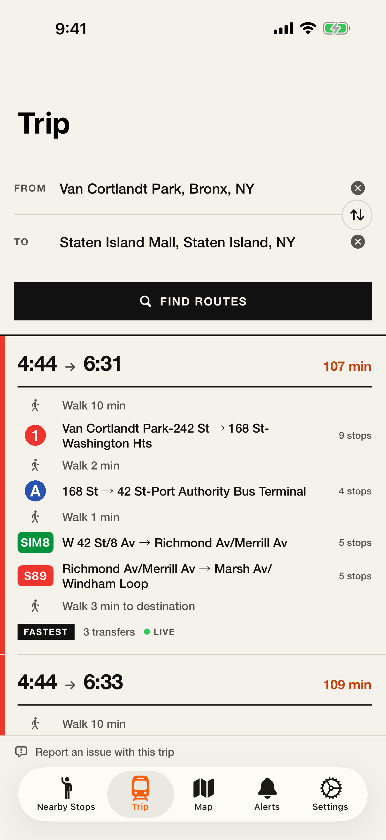
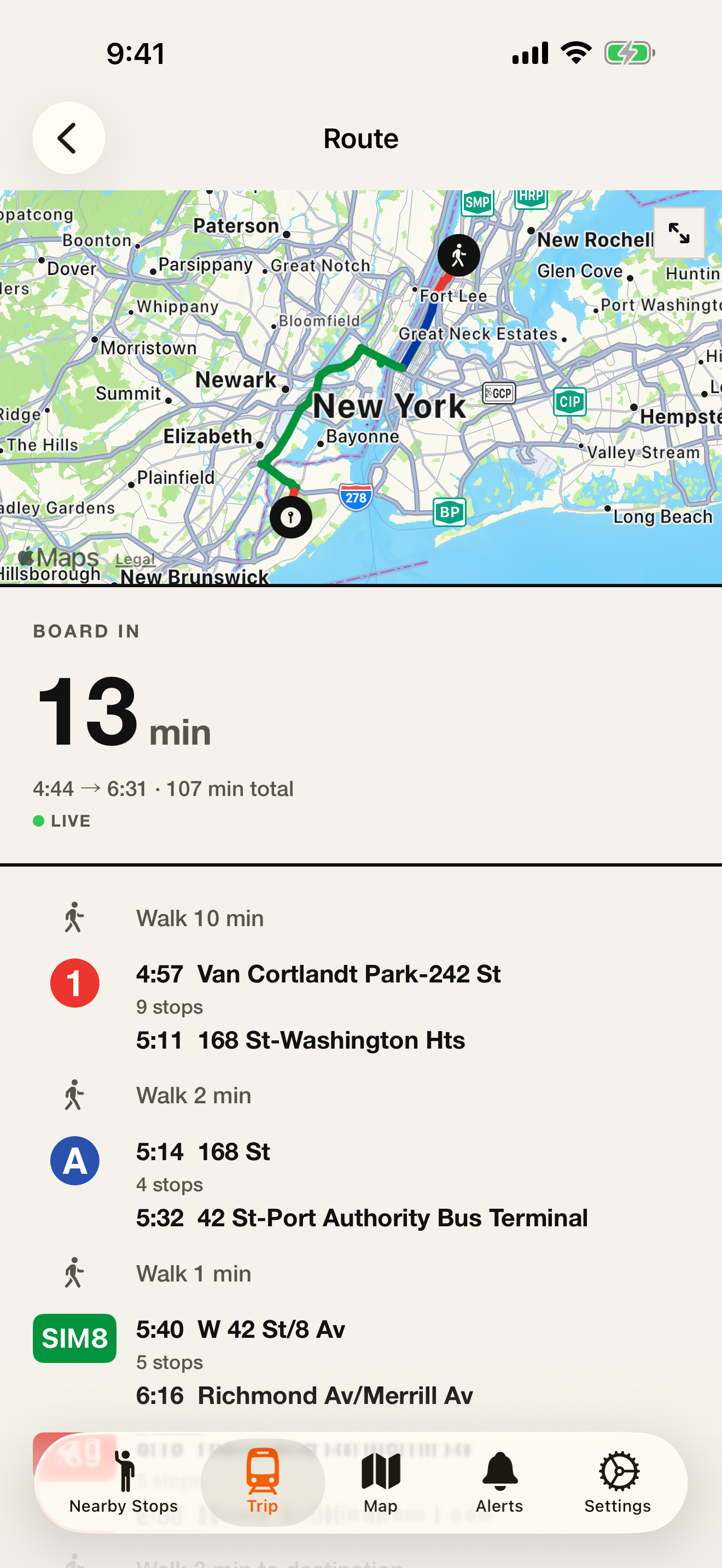
Some days, you need more than the next train. Find a route, compare your options, and see every walk and transfer along the way.
On-device trip planning is in beta. Check your network’s features.
03 The bigger picture
Make sense
of the city.
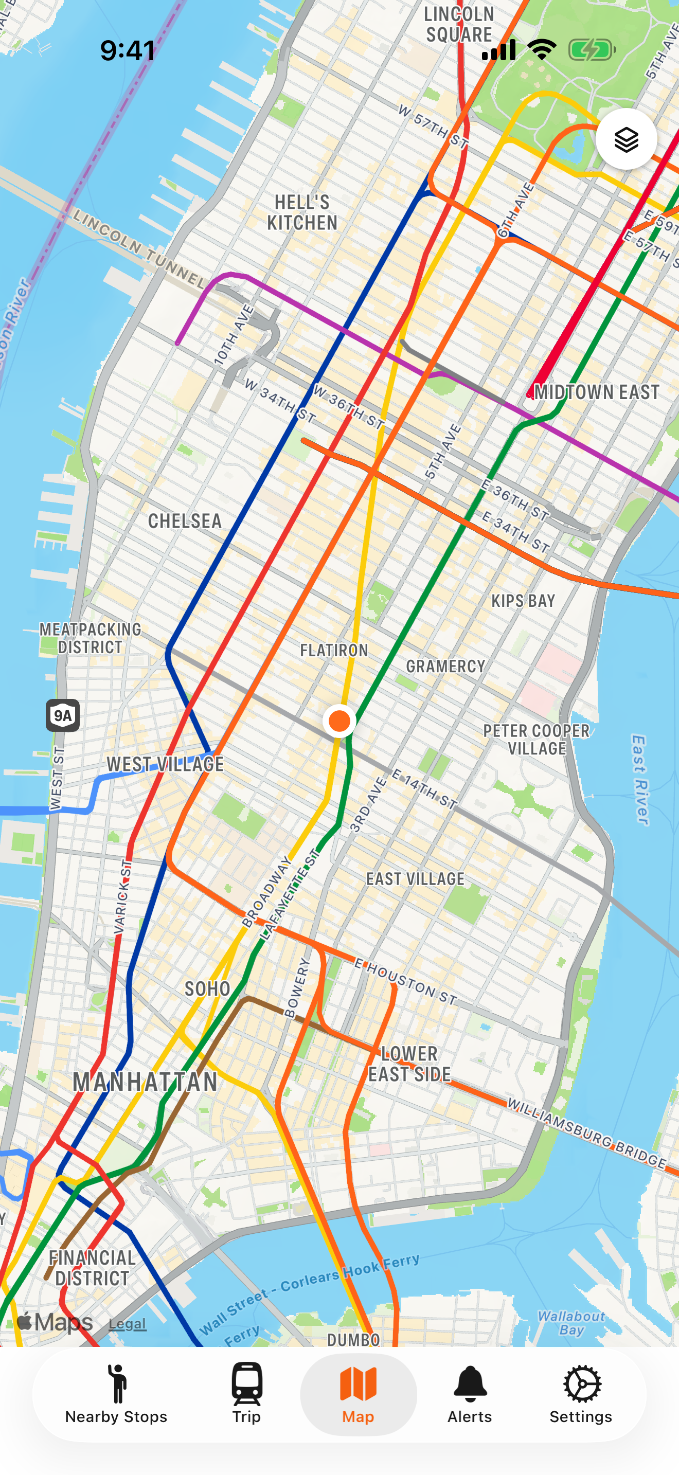
Put the lines on the map. See how the network fits together, from your everyday stop to somewhere entirely new.
04 Fewer surprises
A heads-up.
Before you go.
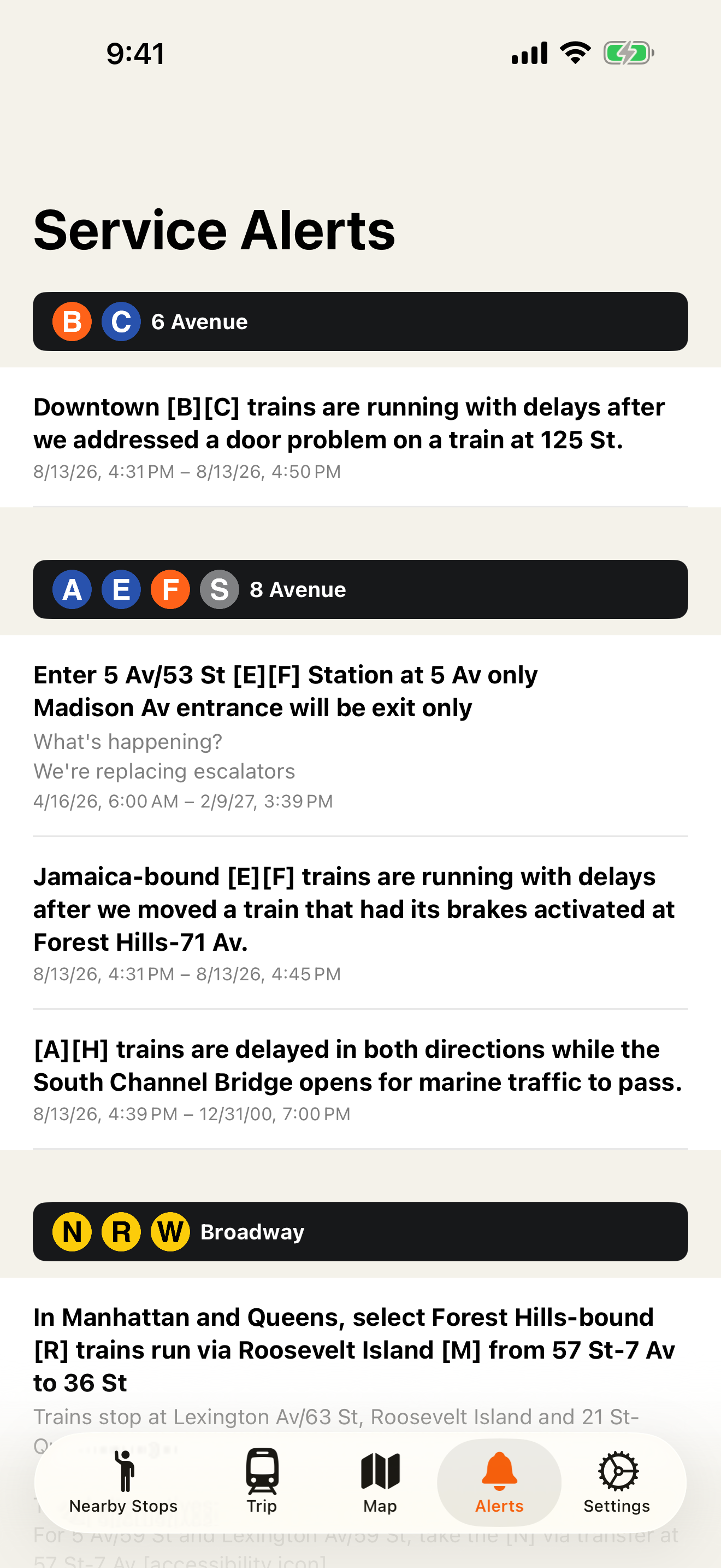
A different platform. A delayed line. Check service changes in one place, before you make your way underground.
Your trip.
Your device.
Route planning happens on your phone, not on our servers. Typed addresses are looked up using Apple Maps. Your daily journey deserves a little privacy, too.
Read about privacyA familiar face.
In more places.
Every city has its own rhythm.
Here’s exactly what’s on board.
- Cities & regions
- 12
- With live arrival boards
- 11
- With on-device trip planning
- 10Beta
| City / network | Arrival boards | On-device trips Beta | Trip timing | Network map | Service alerts |
|---|---|---|---|---|---|
New YorkUSSubway, MTA buses & LIRRWhat’s coveredNearby boards cover the subway, MTA buses and LIRR. Trip planning also includes Metro-North, PATH and the Staten Island Ferry. Turn on bus stops in the app to show nearby buses. | Live arrivals | On device | Live + schedules | Lines + stops | Subway alerts |
PhiladelphiaUSSEPTA MetroWhat’s coveredSEPTA Metro rail and trolley services. Not SEPTA Regional Rail or the city bus network. | Live arrivals | On device | Live + schedules | Lines + stops | Network alerts |
AtlantaUSMARTA railWhat’s coveredThe Red, Gold, Blue and Green rail lines. Live arrival boards; trip planning uses published schedules. MARTA buses are not included. | Live arrivals | On device | Schedules only | Lines + stops | Not available |
BostonUSMBTAWhat’s coveredNearby boards focus on subway and light rail. Trip planning and the map use the broader MBTA network, including commuter rail, buses and ferries. | Live arrivals | On device | Live + schedules | Lines + stops | Network alerts |
San Francisco Bay AreaUSBARTWhat’s coveredBART rail across the Bay Area. Not Muni, Caltrain or the regional bus network. | Live arrivals | On device | Live + schedules | Lines + stops | Network alerts |
ChicagoUSCTA “L”What’s coveredThe eight “L” rail lines. Live arrival boards; trip planning uses published schedules. Not CTA buses or Metra. | Live arrivals | On device | Schedules only | Lines + stops | Not available |
LondonUKLondon UndergroundWhat’s coveredTube arrival boards, with line notices on station cards. No on-device trip planner or network-map overlay. Not the full TfL bus or regional rail network. | Live arrivals | Not available | Not available | Not available | Station boards |
BerlinDEU-Bahn & S-BahnWhat’s coveredU-Bahn and S-Bahn arrival boards, network map and on-device trips. Live arrivals were restored and verified on September 11. Not the full VBB bus and tram network. | Live arrivals | On device | Live + schedules | Lines + stops | Not available |
SydneyAUSydney Trains & intercityWhat’s coveredSydney Trains and intercity train services. Not Sydney Metro, buses or ferries. Arrivals are live; the separate service-alert feed is currently unavailable. | Live arrivals | On device | Live + schedules | Lines + stops | Feed unavailable |
DublinIELuasWhat’s coveredLive tram arrival boards for the Red and Green lines. No on-device trip planner or network-map overlay. Not DART, commuter rail or Dublin buses. | Live arrivals | Not available | Not available | Not available | Not available |
Kansas CityUSKC StreetcarWhat’s coveredScheduled trip planning and a streetcar network map are available. Live arrival boards are pending data access. RideKC buses are not included. | Live arrivals pending | On device | Schedules only | Lines + stops | Not available |
Minneapolis–St. PaulUSMETRO Light RailWhat’s coveredBlue and Green light rail, including downtown Minneapolis, St. Paul, the airport and Mall of America. Buses and the separate airport shuttle are not included. Walking connections use distance estimates. | Live arrivals | On device | Live + schedules | Lines + stops | Network alerts |
- Live arrivals ≠ live trip updates.
- Some networks provide station predictions but not delays the trip planner can use. “Live + schedules” applies updates where trips can be matched, with schedules as a fallback.
- A network map, on your phone.
- Lines and stops come from the downloaded network data. Map coverage can be broader than nearby arrival boards; open “What’s covered” for the detail.
- Different feeds. Different features.
- Alerts depend on what each agency supplies. London notices appear on station boards. Kansas City’s live data is pending; its scheduled trip planner is ready.
Coverage reviewed . This is a coverage guide, not a live service-status page. Features and predictions depend on the network and its available data.
What do I see when I open FastStation?
With location access, FastStation opens to the stops around you and their upcoming departures. See the route, direction and estimated walk without searching for a station first. Pin the stops you use regularly.
Where can I plan a trip on my phone?
On-device trip planning is available in New York, Philadelphia, Atlanta, Boston, San Francisco Bay Area, Chicago, Berlin, Sydney, Kansas City, and Minneapolis–St. Paul. It is in beta, and each network has different coverage. London and Dublin currently offer arrival boards without a trip planner.
Does everything work without a signal?
Not everything. Route calculations use network data downloaded to your phone. Getting that data, refreshing live arrivals and looking up a typed address still need a connection. Address lookup uses Apple Maps.
Is FastStation free? What about Android?
FastStation is free for iPhone and iPad, with iOS 26.0 or iPadOS 26.0 or later. Android is coming soon; there is no Android download available here yet.
Next stop
Out the door.
Your nearest stations. Your next train. One app away.